These weather conditions may lead to the formation of severe thunderstorms and hail in the eastern and southern regions of the Eastern Cape.

Low-lying settlements will be at risk, including roads and bridges. iStock photo for illustration purposes.
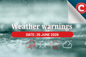
The South African Weather Service issued yellow level 2 warnings for severe thunderstorms in the Eastern Cape on Thursday and Friday.
Long weekend weather update
The weather service said “a surface trough, coupled with an upper-air trough, is expected to lead to thunderstorms in the eastern parts of the province”.
These conditions will lead to “higher instabilities” in the region which could possibly cause severe thunderstorms to develop along the eastern and southern parts of the Eastern Cape.
Severe weather conditions
In addition to heavy downpours, SAWS also warns of strong winds and hail. Combined, these weather conditions could result in localised damage to property and infrastructure.
Low-lying settlements will be at risk, including susceptible roads and bridges.
In addition, the weather service warns of power interruptions as well as the interruption of communication services and agricultural production.
Rainfall chart
As per today’s rainfall probability chart, isolated showers are also expected in the Western Cape, Free State, KwaZulu-Natal, and in parts of the North West and Gauteng.
Anyone in the area should be prepared for the possibility of severe weather and take appropriate precautions to stay safe.
READ: Isolated afternoon showers and thundershowers expected in Gauteng
General safety tips
Follow a few essential guidelines to stay safe during a thunderstorm.
- It is vital to stay indoors and avoid open spaces such as parks or fields. Also ensure all doors and windows are closed, and all electrical appliances and devices are unplugged.
- If you do happen to be caught outside during a thunderstorm, avoid stalls trees and bodies of water such as rivers and lakes.
- If possible, find shelter in a building or a car while waiting for the storm to pass.
Road safety during storms
- Motorists are urged to slow down, be cautious, although it is advised to stay off the roads during a storm.
- Keep your headlights on low beams (dim) since high beams (bright) can reflect off the rain.
- Lastly, avoid trees and any tall structures that may be struck by lightning.
READ: El Niño coupled with rolling blackouts could spell trouble for SA agriculture