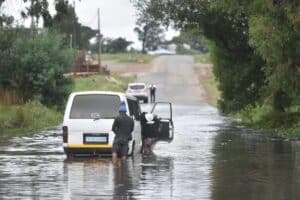
Rain is expected to return to many of the country's provinces, ahead of and during the coming Easter weekend.

The South African Weather Service (SAWS) has upgraded the heavy rain warning in KwaZulu-Natal (KZN) to an Orange level 9 for the remainder of Tuesday, from level 8 on Monday evening.
A yellow level 4 warning for disruptive rainfall has also been issued over the south-eastern interior of KZN, while an orange level 6 warning for disruptive rain has been issued over Port St Johns LM, Ingquza Hill LM and Mbizana LM in the Eastern Cape, on Tuesday.
“Overnight rainfall reports from KwaZulu-Natal have underscored the particularly heavy and extreme nature of the rainfall, with some 24-hour falls exceeding 200 mm, while a few stations reported 300 mm or more,” said the weather service on Tuesday.
“Such rainfall is of the order of values normally associated with tropical cyclones; however, SAWS must strongly emphasise that this system is not tropical in nature, nor is it a tropical cyclone.”
ALSO READ: KZN flood death now toll at 45, govt expects more fatalities
What was the reason for the heavy rain?
According to the weather service, the cut-off low system responsible for the inclement weather began moving eastwards over KwaZulu-Natal and the Eastern Cape overnight. Cut-off lows are associated with widespread instability in the atmosphere, which can promote periods of prolonged rainfall, as witnessed over many of the interior provinces of South Africa at the weekend.
“For KwaZulu-Natal however, the effect of the cut-off low system has been markedly enhanced by the presence of sustained low-level maritime air which has been fed in from the southern Indian ocean, thus driving the system to produce more rainfall. Moreover, the original source of the maritime air was from warmer, sub-tropical parts of the ocean, with a greater capacity to transport moisture, an essential ingredient of any rain-producing system,” it said.
The good news is, according to the weather service, by Wednesday the current rainfall system will have weakened considerably, heralding a spell of a few days of settled dry weather.
“However, the public should take note that rain is expected to return to many of our provinces, ahead of and during the coming Easter weekend, when many people will be traveling to other parts of the country.”
Wednesday’s weather forecast
Gauteng: Partly cloudy and cool but warm in the north. The expected UVB sunburn index: Low
Mpumalanga: Morning fog patches over the western Highveld, otherwise partly cloudy and cool to warm but hot in the Lowveld with isolated showers.
Limpopo: Partly cloudy and warm to hot.
North West: Cloudy with morning fog patches in the extreme east, otherwise partly cloudy and cool to warm with isolated showers and rain in the extreme east.
Free State: Partly cloudy and cool to warm.
Northern Cape: Fine and warm, but cool over the southern high ground, becoming cloudy along the coast from evening. The wind along the coast will be Moderate to fresh south-easterly, strong in the afternoon.
Western Cape: Morning fog along the coastal regions where it will be cool becoming partly cloudy otherwise fine and warm over the interior. It will become cloudy along the south coast with light rain in the west from the evening. The wind along the coast will be moderate to fresh south-easterly but south-westerly along the south coast. The expected UVB sunburn index: Moderate
Western half of the Eastern Cape: Partly cloudy and warm, becoming cloudy in places along coast in the afternoon. The wind along the coast will be Moderate to fresh south westerly.
Eastern half of the Eastern Cape: Cloudy along the Wild coast at first with isolated showers and rain, otherwise partly cloudy and cool to warm. The wind along the coast will be Moderate to fresh south westerly.
KwaZulu-Natal: Cloudy in the south with isolated morning showers in the south-east, otherwise partly cloudy and warm. The wind along the coast will be Moderate northerly to north-easterly, becoming fresh to strong westerly to south-westerly south of Durban in the afternoon. The expected UVB sunburn index: High


