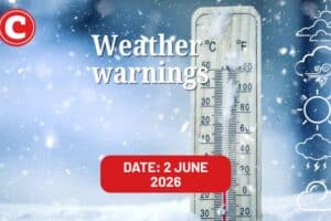
Find out what the latest weather forecast from the SA Weather Service means for your region.

Picture: iStock
The South African Weather Service (Saws) has released its latest weather forecast for Saturday, 22 February 2025.
Saws has issued a yellow level 2 warning for severe thunderstorms with localised flooding expected in parts of North West, Free State, Gauteng and Kwa-Zulu Natal. Here’s what you need to know.
Weather warnings, Saturday, 22 February
Impact-based warnings
The weather service has issued a yellow level 2 warning for severe thunderstorms expected over the central and south-eastern parts of North West, eastern and northern parts of Free State, extreme south parts of Gauteng as well as as the western parts of Kwa-Zulu Natal.
Such conditions could result in damaging winds, excessive lighting, hail and heavy downpours that could possibly cause localised flooding in low-lying areas, on roads and bridges, and damage to property and infrastructure.
ALSO READ: UPDATE: Six people dead as heavy rains trigger devastating mudslides in KZN
Provincial weather forecast
Here’s what to expect in your province on Saturday, 22 February:
Gauteng:
Residents of Gauteng can expect partly cloudy and warm conditions with isolated showers and thundershowers, although scattered in extreme south.
Mpumalanga:
Mpumalanga residents can expect to wake up to cloudy conditions in the east at first with morning fog patches along the escarpment, otherwise it will be partly cloudy and warm with isolated showers and scattered thundershowers in southern Highveld. The weather will be hot in the Lowveld.
Limpopo:
The day will start off cloudy in the east with morning fog patches on the escarpment, otherwise it will be partly cloudy and warm to hot with isolated showers.
North West:
Weather conditions will be partly cloudy and cool, with isolated showers and thundershowers but scattered over the central and the south-eastern parts.
Free State:
Residents of the Free State will experience partly cloudy and cool conditions, with isolated showers and thundershowers, but scattered over the eastern and northern parts.
Northern Cape:
The day will start cloudy with morning fog along the coast becoming fine and warm to hot in west, otherwise partly cloudy and cool to warm with isolated showers and thundershowers over the extreme east.
Western Cape:
Western Cape residents can expect to wake up to morning fog along the west coast, with weather conditions becoming fine and warm to hot, otherwise it will be partly cloudy and warm with isolated afternoon thundershowers over the eastern interior, where it will be hot.
Eastern Cape (western half):
Weather conditions will be partly cloudy and warm with isolated showers and thundershowers. It will be hot in the extreme north with moderate to fresh south-westerly winds, becoming moderate easterly to north-easterly from the afternoon.
Eastern Cape (eastern half):
It will be partly cloudy and warm with isolated showers and thundershowers but scattered in the north-east.
KwaZulu-Natal:
Residents of KwaZulu-Natal can look forward to morning fog patches in places over the interior, otherwise partly cloudy and cool to warm but hot in places in the north with scattered showers and thundershowers, but isolated in the east.