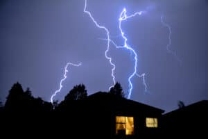
South Africa faces strong, damaging winds and minimal rain in the first spring thunderstorms of the season, causing extensive damage in the eastern regions.

South Africa’s first spring thunderstorms have resulted in reports of wind-related damage such as uprooted trees, damage to farming equipment and blown off roofs across the eastern parts of the country.
The South African Weather Service (Saws), despite issuing warnings, yesterday revealed the first thunderstorms of the new season were eagerly awaited in Free State, Gauteng and North West.
According to the service, these storms were characterised by widespread reports of strong, damaging surface winds as well as modest amounts of rain.
On Tuesday afternoon, wind speed exceeded 50 knots (114km/h) over Harrismith in Free State between 4.15pm and 4.35pm, which was consistent with the typical strength of a dry microburst.
READ: Pretoria storm uproots trees, damages cars and buildings
Later in the evening, towards 9pm, strong surface wind gusts of 40 to 46 knots, in association with thunderstorm activity, were reported over the central and southern parts of North West and between 9pm and 11pm with reports of strong winds as well as widespread blowing dust were reported across Gauteng, including Soshanguve, Mamelodi, Pretoria and Centurion.
“Wind measurements suggest gusts slightly in excess of 100km/h at these localities. Although thunder was heard, generally very little precipitation arrived at ground level,” the service said.
The service said such storms were not usually associated with delivering much rainfall which explained the term “dry thunderstorms” and that these types of storm developments could occur at any time of the year but early summer season storms were notorious of frequently being associated with strong, damaging winds caused by “dry microbursts”.
“Radar and satellite remote sensing data provided little or no indication of possible severity of storms, however, a feature which proved to be significant was that, given the very dry conditions at the surface, the convective cloud base of the thunderstorms was at a high altitude above the ground,” the weather service stated.
READ: What to expect across South Africa on 21 Sept
The weather service noted that a microburst was a localised column of sinking air (also known as a downdraft) within a thunderstorm and is usually less than or equal to 4km in diameter.
Microbursts could cause extensive damage upon reaching the earth’s surface, and could be life-threatening.
“In the case of a dry microburst, the precipitation evaporates aloft within the downdraft, causing the downdraft air to become colder and denser, thus accelerating the cold air towards the ground, under the influence of gravity,” said the service.
“This phenomenon is associated with high cloud base thunderstorms, as was the case on Tuesday. This weather phenomenon has a capability of uprooting trees and lifting off building roofs.”
The service added significant damage was reported over the eastern and the northeastern parts of Free State, eastern and the south-eastern parts of North West.
“In Bethlehem, over 50 houses were affected by the adverse weather conditions. Significant wind damage was reported to have occurred at Moruleng Mall, about 60km from Rustenburg,” they said.


