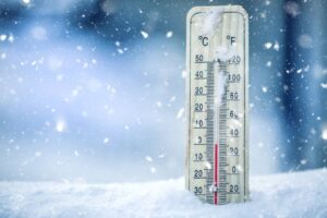
La Niña may bring wetter conditions and boost agriculture in South Africa, but dam levels and water management are still crucial this summer.

La Nina is expected to develop in SA towards the end of 2024, according to the World Meteorological Organisation. Picture: iStock
Although a La Nina rainy season is predicted for South Africa, it does not mean the country is not in danger of low dam levels this summer.
This week, the World Meteorological Organisation predicted a 60% chance of La Nina developing by the end of 2024.
This could bring about favourable conditions for much-needed rain for the agriculture sector and the water supply.
Gauteng alright for now
Environment, climate change and water expert Dr Ferrial Adams said looking at the Integrated Vaal River System, Gauteng seems to be alright for now.
“In terms of water shortages, in general around the summer there is a call for people to use water more sparingly because demand increases,” she said.
ALSO READ: Full river systems, heavy rain and La Niña hold potential for ‘disaster’
The University of Pretoria’s Prof Willem Landman said La Nina meant SA could look forward to above-normal mean maximum temperatures during spring.
But below-normal maximum temperatures were forecast for parts of northern southern Africa towards summer.
Vox Weather meteorologist Michelle Cordier said this was because La Nina causes temporary cooling of ocean surface temperatures in the Pacific Ocean.
La Niña affects
“The cooling of the Pacific Ocean during La Nina affects weather patterns across the globe, including South Africa, through changes in atmospheric circulation which often bring wetter conditions to northeastern South Africa.
“During La Nina, the trade winds [winds that blow from east to west near the equator] become stronger. These winds push warm water westerly and allow cooler water to surface in the central and eastern Pacific.”
ALSO READ: LISTEN: Expect a wet 2023, with above normal rainfall until expected till autumn
Cordier said currently the neutral weather conditions would prevail until October, while La Nina was expected to emerge until February 2025.
Cordier said for SA, particularly in the northeastern parts, La Nina strengthens the flow of moisture-laden winds from the Indian Ocean.
“The stronger trade winds help carry warm, moist air from the ocean inland.
More cloud formation and rainfall
“This air rises when it hits mountain ranges or interacts with other weather systems, which leads to more cloud formation and rainfall.
“The presence of more moisture in the air combined with favourable conditions for convection [rising of warm air creating clouds and rain] leads to an increase in thunderstorms and heavier rainfall,” she said.
ALSO READ: El Niño and La Niña: What is the difference between the two climatic phenomena ?
“They are also predicting above-normal rainfall by the mid-summer, but the winter rainfall region may experience drier than normal conditions during spring.
“They are predicting above-normal mean maximum temperatures over big parts of SA during spring, with below-normal maximum temperatures over parts of northern southern Africa towards summer,” she said.
Agricultural Business Chamber of South Africa (Agbiz) chief economist Wandile Sihlobo said the 2024-25 season seems likely to be a recovery period, with an optimistic outlook for rain.
Above-normal rain
Sihlobo said above-normal rain would fall during a critical period for SA’s summer grains and oilseeds between October and the end of February 2025.
“In the 2023-24 season, the drought was at its harshest as the crop started the pollination period from February to the end of March.
ALSO READ: Wet, chilly summer here to stay for a while, due to La Niña
Current predictions indicate wetter conditions along the southeastern coastal areas in spring and the central parts in early summer.”