Find out what the latest weather forecast from the SA Weather Service means for your region.

Picture: Canva
The South African Weather Service (Saws) has released its latest weather forecast for Friday, 5 July 2024.
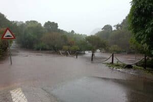
Brace yourselves this weekend as a series of intense cold fronts approaches the country and temperatures are expected to drop significantly. Snow is forecast over the mountains in the Eastern Cape and Western Cape this weekend. Here’s what you need to know.
Weather warnings, 5 July
Impact-based warnings
The weather services have issued a yellow level 2 warning for damaging waves resulting in difficulty in navigation at sea, and small vessels at risk of taking on water and capsizing are expected between Saldanha Bay and Plettenberg Bay.
A yellow level 4 warning is also issued for damaging wind and waves resulting in disruption to harbours and ports, difficulty in navigation with vessels at risk of capsizing, dragging anchors, and breaking mooring lines between Plettenberg Bay and Port Edward.
Saws also issued a yellow level 2 warning for damaging winds resulting in damage to property, difficult driving conditions, localised communication, and power interruptions over Kouga, Nelson Mandela Bay, Ndlambe, Makana, Ngqushwa, and Buffalo City local municipalities of the Eastern Cape.
Advisories
There will be very cold conditions, and light snow is expected in places over high ground in the interior of the Eastern Cape.
The weather service added that a series of intense cold fronts are expected to affect the Western Cape, Northern Cape, and Eastern Cape from Sunday to next Friday. The public and small stock farmers are advised that snowfalls, very cold conditions, strong coastal and interior winds, and very rough seas can be expected, with heavy rainfall likely over the western parts of the Western Cape.
Provincial weather forecast
Here’s what to expect in your province on Friday, 5 July
Gauteng:
Residents of Gauteng can anticipate morning frost in some places; otherwise, it will be fine and cool but cold in the south.
The region’s expected UVB sunburn index is “high.”
Residents should take the necessary precautions against prolonged sun exposure.
Mpumalanga:
Mpumalanga residents can expect morning frost in places on the highveld; otherwise, conditions will be fine and cold to cool but warm in the lowveld.
Limpopo:
The day will be fine and cool to warm.
North-West province:
Morning frost over the central and western parts awaits North West residents; otherwise, it will be fine and cool. It will be windy in the south.
Free State:
Residents of the Free State will see morning frost in places; otherwise, the weather will be fine, windy, and cold to cool, becoming partly cloudy in the south with light afternoon showers in the extreme south-east.
Northern Cape:
The day will start with morning frost in the east; otherwise, it will be fine and cold to cool, but partly cloudy over the central and southern parts in the morning with light showers in the extreme south-east. Morning fog patches are expected over the western and central interior.
Western Cape:
Western Cape residents can expect cloudy to partly cloudy and cold to cool conditions with isolated morning showers over the southern and western parts.
Eastern Cape (western half):
It will be partly cloudy to cloudy, windy, and cold to very cold, with isolated showers and rain scattered along the south coast. Light snowfalls are expected in the high-lying areas.
Eastern Cape (eastern half):
It will be fine and cold to very cold, becoming cloudy in places with isolated light showers in the west and light snowfalls over the northern interior.
KwaZulu-Natal:
Residents of KwaZulu-Natal can look forward to fine and cool weather, but warm in the north-east.
The region’s expected UVB sunburn index is “very high.”
Residents should take the necessary precautions against prolonged sun exposure.