SAWS says some disruptive snowfalls can also be expected over the Western Cape tonight, but mainly over the higher mountains of the region.

JOHANNESBURG, SOUTH AFRICA – MAY 14: Sthembiso Mabalane braves the elements after a cold front on May 14, 2017 in Johannesburg, South Africa. (Photo by Gallo Images / Sowetan / Kabelo Mokoena)
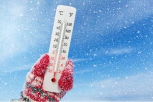
The South African Weather Service (SAWS) has said the cold front that made landfall on Monday afternoon is “typical of late winter” weather as the country moves to lockdown level 2 on Tuesday.
“Showers (heavy in places over the southwestern parts) are expected over the Western Cape, spreading to the western parts of the Eastern Cape later.
“Some disruptive snowfalls can also be expected over the Western Cape tonight, but mainly over the higher mountains of the region, including Sutherland (Northern Cape) and Beaufort West (Western Cape).”
Meanwhile, Storm Report SA posted a video on Monday with a caption that it has received reports of snowfall in Table Mountain.
⚠BREAKING
We have a report that it is currently snowing on Table Mountain in Cape Town. Does anyone have more info? We have no idea who to credit. pic.twitter.com/CGX6Kt6Bgv— Storm Report SA (@StormReportSA1) August 17, 2020
SAWS said the cold front was expected to have hit the Eastern Cape by Tuesday, “when snowfalls (disruptive in places) can be expected at localities such as Graaf Reinet, Craddock and Queenstown”.
“Some rainfall along the southern Cape coast and adjacent interior could be heavy, leading to localised flooding in localities such as George, Plettenberg Bay and Jeffrey’s Bay are likely areas, regarding the risk of heavy rainfall.
“Isolated showers or thunderstorms are expected to deliver light rainfall to the Free State, KwaZulu-Natal (KZN) and the southern highveld tomorrow, Tuesday, 18 August 2020.”
Gauteng and the eastern highveld of Mpumalanga can expect “a few rumbles of thunder, albeit shortlived and of a non-severe nature, in the afternoon and evening hours”.
“There will also be a localised risk of runaway fires (dangerously high FDI rating in the red category) over the northeast Free State as well as the Drakensburg highlands of KZN tomorrow, ahead of the advancing cold front.
“This is a typical phenomenon to be expected at this time of year, when there is an abundance of fuel in the form of dry grasslands.”
SAWS said marine conditions are expected to be “fairly unsettled” in the open ocean on Tuesday, “with very rough seas as well as gale-force westerly to southwesterly winds along an extensive section of the southern coastline, between Cape Point and Port St Johns”.
“Coastal regions, however, are not expected to be significantly impacted.”
⚠️Media Release⚠️: Typical late winter weather as we move into Lockdown Level 2. pic.twitter.com/bo9Xvq4SFv
— SA Weather Service (@SAWeatherServic) August 17, 2020
(Compiled by Makhosandile Zulu)
For more news your way, download The Citizen’s app for iOS and Android.