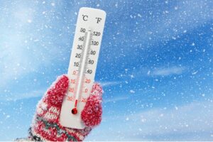
Below-zero temperatures are expected to hit the province.

JOHANNESBURG, SOUTH AFRICA – MAY 14: Sthembiso Mabalane braves the elements after a cold front on May 14, 2017 in Johannesburg, South Africa. (Photo by Gallo Images / Sowetan / Kabelo Mokoena)
Gauteng residents should brace themselves for a two-day cold front, starting on Tuesday, according to the South African Weather Service (SAWS).
Temperatures are likely to dip to below zero on Wednesday morning, heating up a bit more from Thursday, according to SAWS forecaster Edward Engelbrecht.
A 30% chance of light rain is expected for Tuesday, he said.
Pretoria will experience a maximum of 19 degrees on Tuesday and 17 degrees on Wednesday.
Johannesburg will see below-zero temperatures for Wednesday morning, going up to 14 degrees during the day, Engelbrecht said.
Thursday will still be slightly cold for the province, but temperatures will improve into the high teens, he added.
Meanwhile, Power utility Eskom on Sunday warned the public that the power system will be severely constrained this coming week due to the unavailability of eight generation units.
In a statement on Sunday, 16 August, Eskom said constraints on the system will also be due to breakdowns or delays in the maintenance programme.
⚠️ALERT: APPROACHING COLD FRONT
Monday⛅️5|21°C????WINDY
❄️COLD FRONT❄️
Tuesday????️-1|17°C☂️15%????
Wednesday????️2|17°C
Thursday☀️3|18°C
Friday☀️4|20°C#JHBWeatherMonday⛅️7|23°C????
❄️COLD FRONT❄️
Tuesday????️1|19°C☂️15%????
Wednesday????️4|19°C
Thursday☀️5|20°C
Friday☀️6|22°C#PTAWeather— Gauteng Weather (@tWeatherSA) August 16, 2020
SAWS also warned that disruptive snowfalls expected over the high lying grounds of Cape Winelands, central Karoo and Garden Route Districts as well as Karoo Hoogland in the Northern Cape. Up to 13cm is indicated for higher elevations.
More snow is expected to fall across parts of South Africa and Lesotho with low-level possible in some places according to Snow Report.
Low-level snow is possible in parts of the Western Cape, Eastern Cape, Northern Cape and Free State and the freezing level may drop as low as 1,000m.
For more news your way, download The Citizen’s app for iOS and Android.