Umgeni River still feeling the effect of last year’s floods
The floods caused substantial damage to the ecosystem of the river as well as the banks on the Blue Lagoon side.

THOUSANDS of people were displaced by the heavy torrential rains in the province in April and May last year that resulted in the loss of more than 440 lives and billions of rands worth of damage to infrastructure.
In fact, a report by charity organisation Christian Aid also listed the floods in KwaZulu-Natal and the Eastern Cape as one of the top 10 costliest extreme events influenced by the climate crisis.
The floods also led to the worsening contamination of the Umgeni River that saw the rise of E. coli (sewage bacteria) to critical levels.
In August last year, the situation came to a head when hundreds of dead fish were found floating between Athlone Bridge and the Umgeni River mouth at Blue Lagoon.
Also read: KZN floods listed in top 10 costliest climate disasters of 2022
The floods also saw a change to the shape of the estuary mouth at Blue Lagoon and subsequently affected the Beachwood Mangroves Nature Reserve.
Part of the promenade walkway under Ellis Brown Viaduct Bridge was also damaged with heavy rocks being displaced as well as damage occurring to the concrete slabbing.
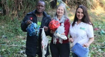
Janet Simpkins, founder of the non-profit organisation (NPO) and environmental body, Adopt-a-River, said while there had been a slight improvement in the water quality, the river’s health remains a concern.
“Many of the problems, particularly with the high E. coli levels, started well before the floods. When the heavy rains came in March and April, it just exacerbated the problems, and the issues were magnified. Since last year, we have continued with our sampling and testing at various points along the river. To date, there has been some improvement, particularly at the Northern Wastewater Treatment Works outlet pipe, but the levels of E. coli are still concerning, especially along Riverside Road.
Also read: Easter weekend brings waves of holidaymakers to uMhlanga
“One of the biggest visible changes to the river is how the estuary mouth has changed. Because of the high seas and floods, there is now a lot more of a sand bank. Because of this, the water flow has been redirected and has been scouring and eroding the edge of the walkway along Blue Lagoon, leading to the collapse of concrete slabbing and in some cases, the removal of rocks used to protect the walkway. The City has brought in more breaker rocks, but with every high sea, more and more of the rocks are being washed away. I do feel this also requires attention as the bank needs to be stablised,” she said.
For more from Northglen News, follow us on Facebook, Twitter or Instagram. You can also check out our videos on our YouTube channel or follow us on TikTok.